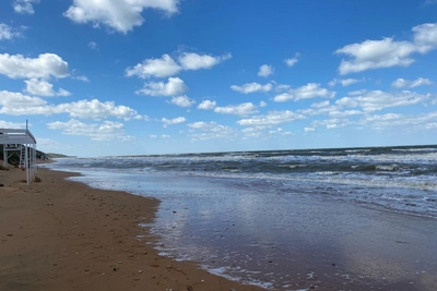
Scientists map the Sea of Azov's muddiest waters
A 20-year Russian Academy of Sciences study has used satellite images to identify where the Sea of Azov is murkiest and where its water stays clearest.
Oct 28, 2026 0


The water is much clearer in summer than in winter.
Source:
Researchers at the Marine Hydrophysical Institute of the Russian Academy of Sciences (RAS) have determined where the Sea of Azov is dirtiest and most turbid. They conducted a 20-year study and published the results in an article titled “Spatial Features and Seasonal Variability of Suspended Matter in the Sea of Azov Water Area Based on Satellite Measurements.”
The research ran from 2003 to 2024. It used satellite images, which were compared with wind data.
It turned out that the dirtiest areas are shallow waters about 6–8 meters (20–26 ft) deep. Second are the Yeysk Peninsula, Dolgaya Spit and Yelenina Balka. Slightly less turbidity is found at Arbat Spit, Biryuchy Island Spit, and near the Obitochnaya and Berdyansk spits. Here the seabed is made of fine silt and clay, which produce such strong turbidity.
The water is much cleaner in the center of the Sea of Azov, where the depth exceeds 10 meters (33 ft). The clearest water is near the Kerch Strait, because cleaner water flows in there from the Black Sea.
“The inflow of Black Sea waters through the Kerch Strait helps reduce the concentration of suspended matter in the southern part of the Sea of Azov,” the scientists write.
As for the Taganrog Bay, river runoff strongly affects turbidity there.
“The Taganrog and Sivash bays are the shallowest areas of the Sea of Azov. Their waters are regularly mixed all the way to the bottom, which causes intense resuspension of bottom sediments,” the article says.
Wind also strongly affects turbidity. A moderate storm lasting 1–2 days lifts mud across almost the entire sea. If the wind is stronger and lasts more than 5 days, the concentration of suspended matter becomes extremely high. When the wind dies down, the water in the center of the sea becomes clear within 3–4 days, because the sediment settles to the bottom.
In winter — especially in January — the water is at its murkiest. That is because winter storms are stronger and longer. And all the water is cold: there is no temperature layer to stop waves from reaching the bottom. In summer the water is clear: there is less wind, and a warm layer forms at the surface that prevents waves from “stirring up” the silt on the bottom.
There was another interesting observation. On satellite images, scientists saw patches of clear water surrounded by turbid water. The explanation turned out to be this: beneath the clear areas lies a sandy bottom, while around them it is silty. Sand is harder to lift, so the water over sand appears lighter and more transparent.
Not long ago, 161.RU reported that mercury, arsenic and other harmful substances had been found in fish from the Sea of Azov. Is it dangerous? We answered that question in this article. And we have gathered everything concerning fish and seas in a single topic page.
Read more