Extreme Traveler from Volgograd Conquers the White Sea by Kayak
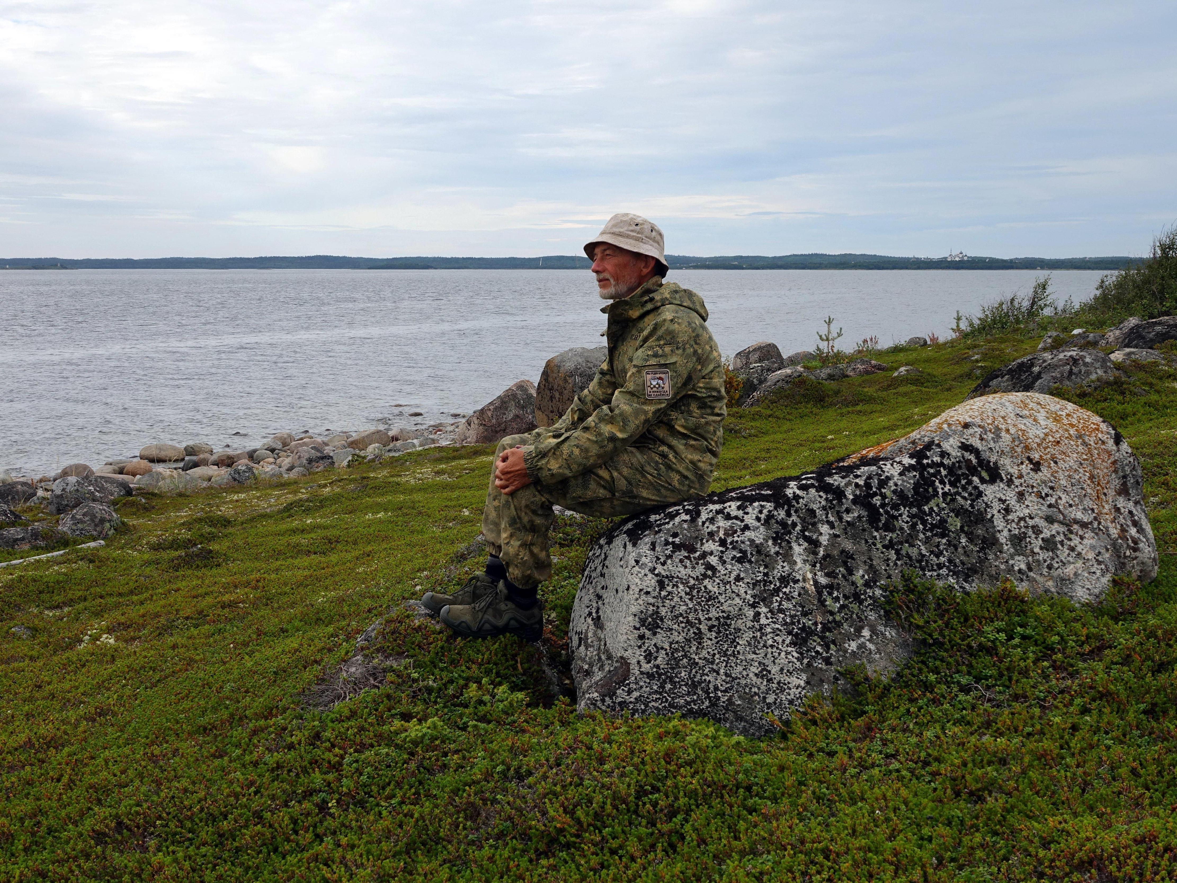

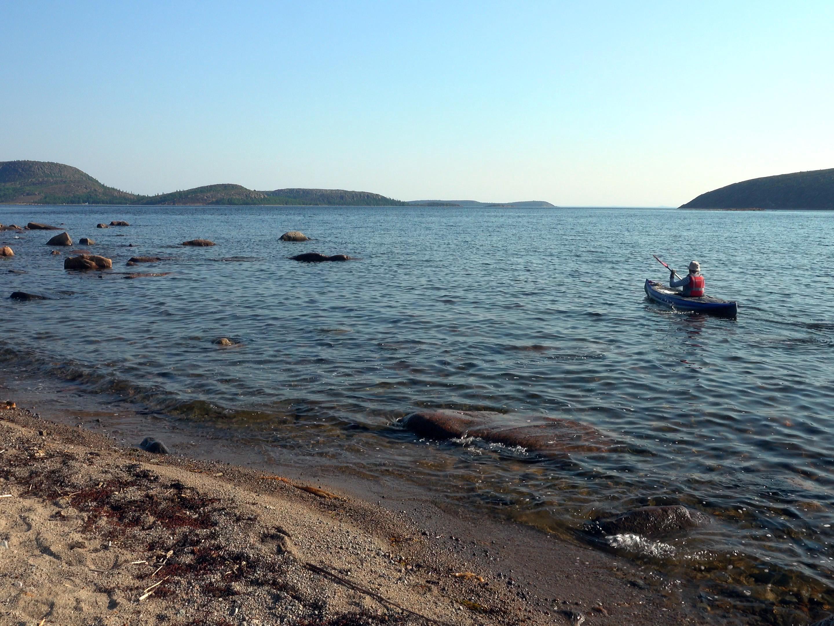
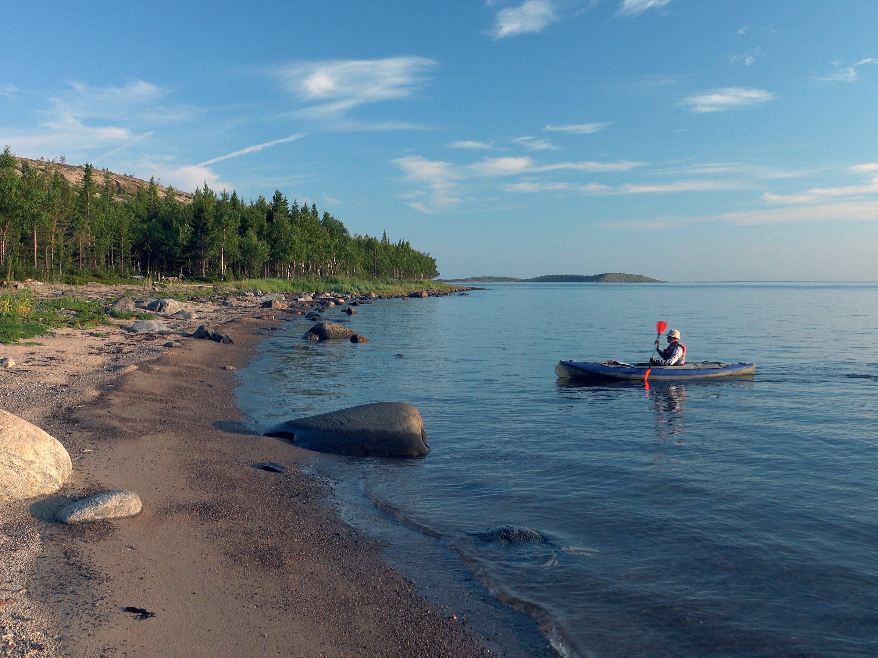
Yevgeny Marsakov on the White Sea.
Yevgeny Marsakov, a member of the Volgograd branch of the Russian Geographical Society (RGS), made his first trip in 1979, just after finishing his studies at a military school. «I decided to try it, and I got hooked,» Marsakov recalls. Recently, Yevgeny completed his forty-fourth trip, conquering the White Sea by kayak.
«He who has never been to sea has never prayed to God»
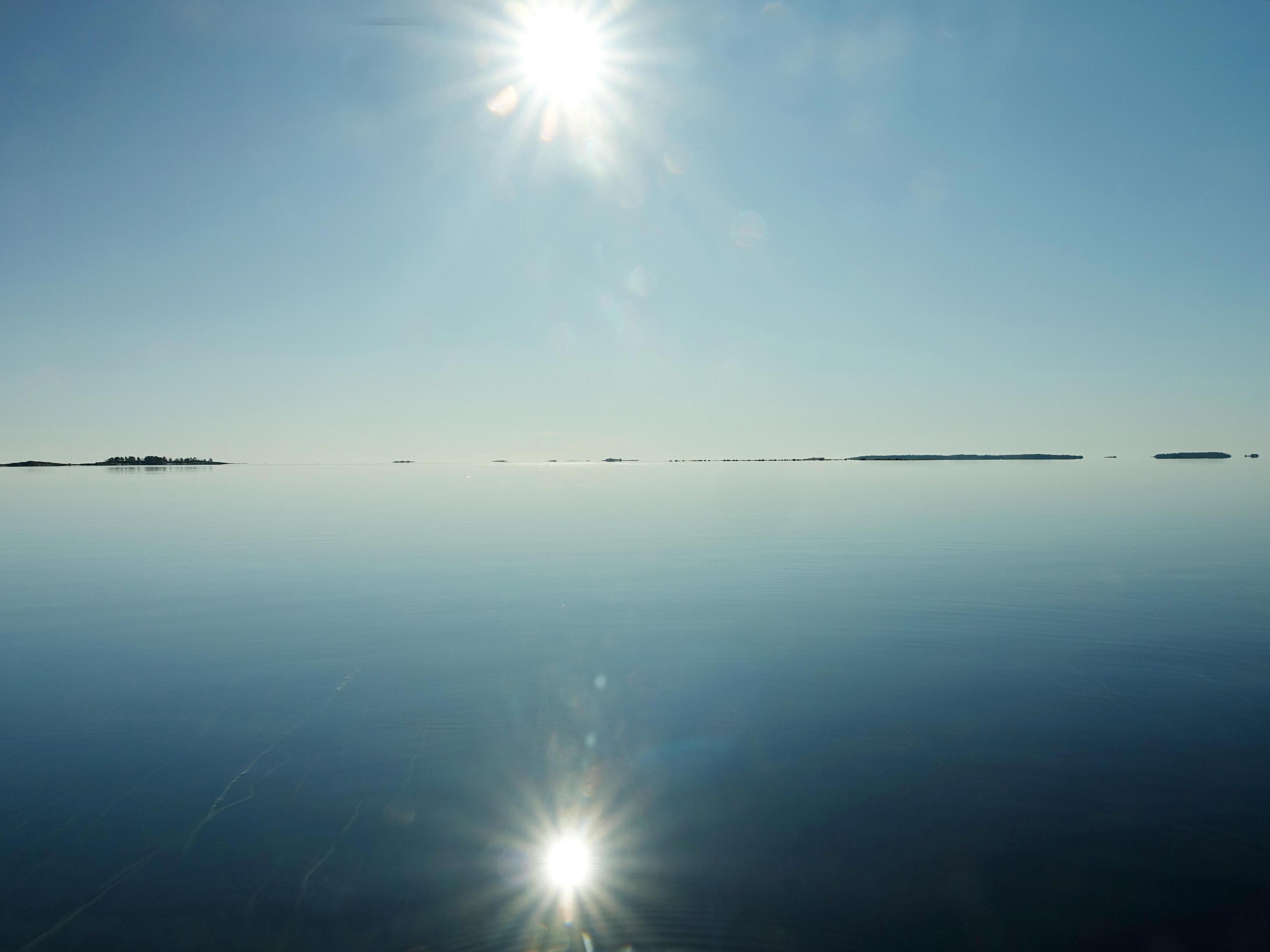
The White Sea.
Yevgeny Marsakov is an officer, a retired lieutenant colonel. He served a quarter of a century in the army, as a test engineer within the Russian Air Force. He is now a military pensioner. After leaving the army, from the end of the last century to the present day, Yevgeny has worked as a video cameraman for various Volgograd television studios.
In earlier times, Marsakov traveled with a comrade, his former classmate Vadim Chernyshev, now a professor and Doctor of Technical Sciences. With him, he says, they «moved from the same desk into the same boat».
But for the past seven years, since 2018, Yevgeny has been going on solo trips. He has been to the Arctic, the Putorana Plateau, and Valdai, where the great Russian river Volga originates. He visited the famous rock pillars on the Sinyaya and Lena rivers in Yakutia, traveled on Lake Teletskoye, rafted down the Biya River in Altai, and covered 800 kilometers (500 miles) along the Amgun and Amur rivers in the Khabarovsk Territory.
The kayak sometimes has to be dragged for a long time to reach clear water.
According to his recollections, the most intense trip was to Kamchatka in 2022. He then traveled almost the entire length of the Kamchatka River by kayak, all the way to the Pacific Ocean, alone.
Kamchatka, as is known, is bear country. On this trip, Yevgeny Marsakov saw bears a dozen and a half times, sometimes literally ten to fifteen meters (33–50 feet) away. He has also encountered bears in other places. Once, on a trip to Lake Baikal, he and a comrade even came literally nose to nose with a brown master of the taiga, who was peeking into their tent window.
— And what were your impressions during that?
— A bear«s nose is cold and wet…
The journey last summer on the White Sea was Yevgeny Marsakov«s second purely sea voyage. The first was in 2012. Then, together with Vadim Chernyshev, they covered about 400 kilometers (250 miles) by kayak along the western coast of the White Sea, from Kandalaksha to Kem. And in the past, 2025, Yevgeny once again made a solo trip to the White Sea region, to an area called the Kem Skerries and around Solovetsky Island.
«So this is it, the Kem Volost…»

The Kem Skerries archipelago.
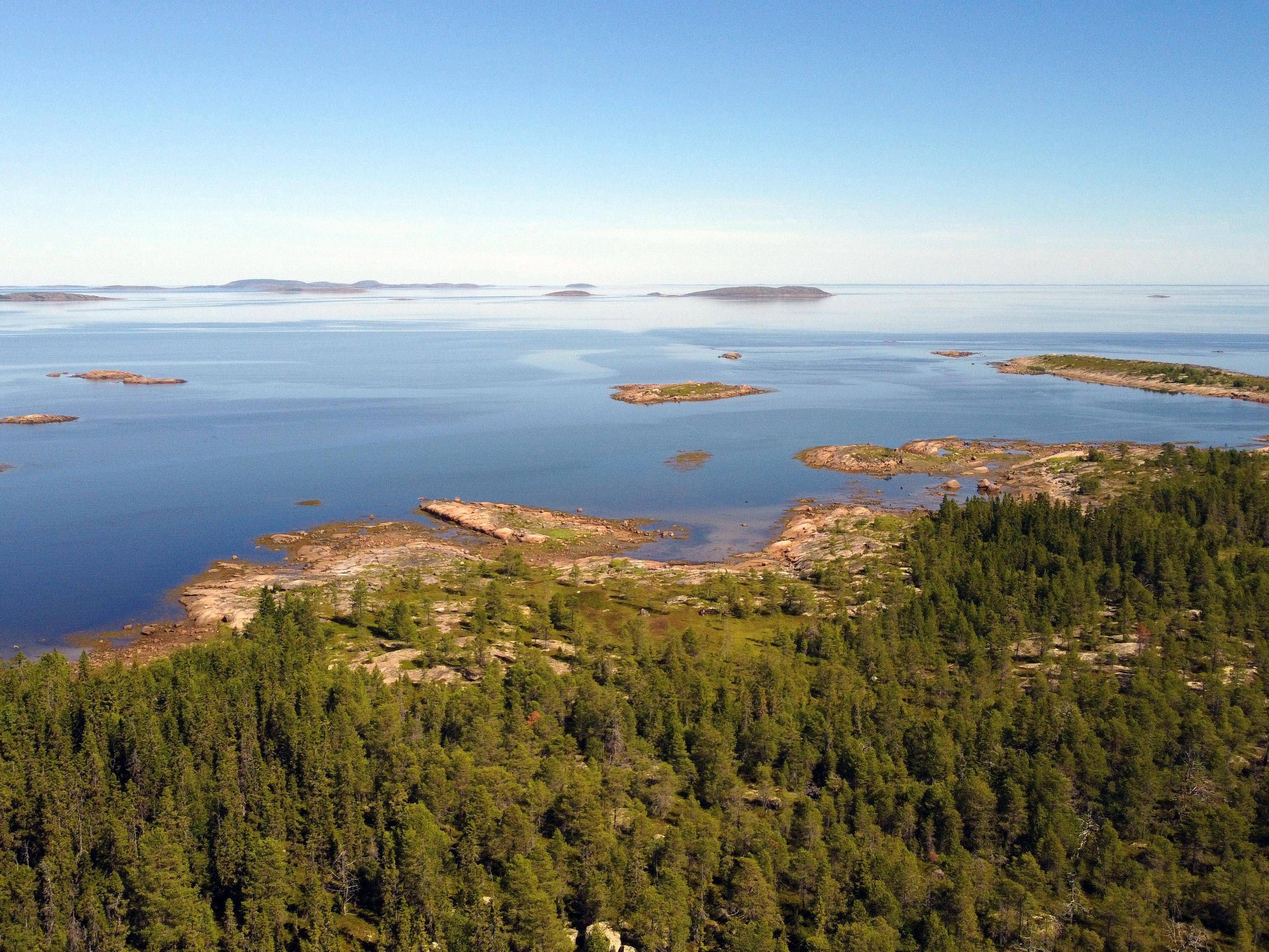
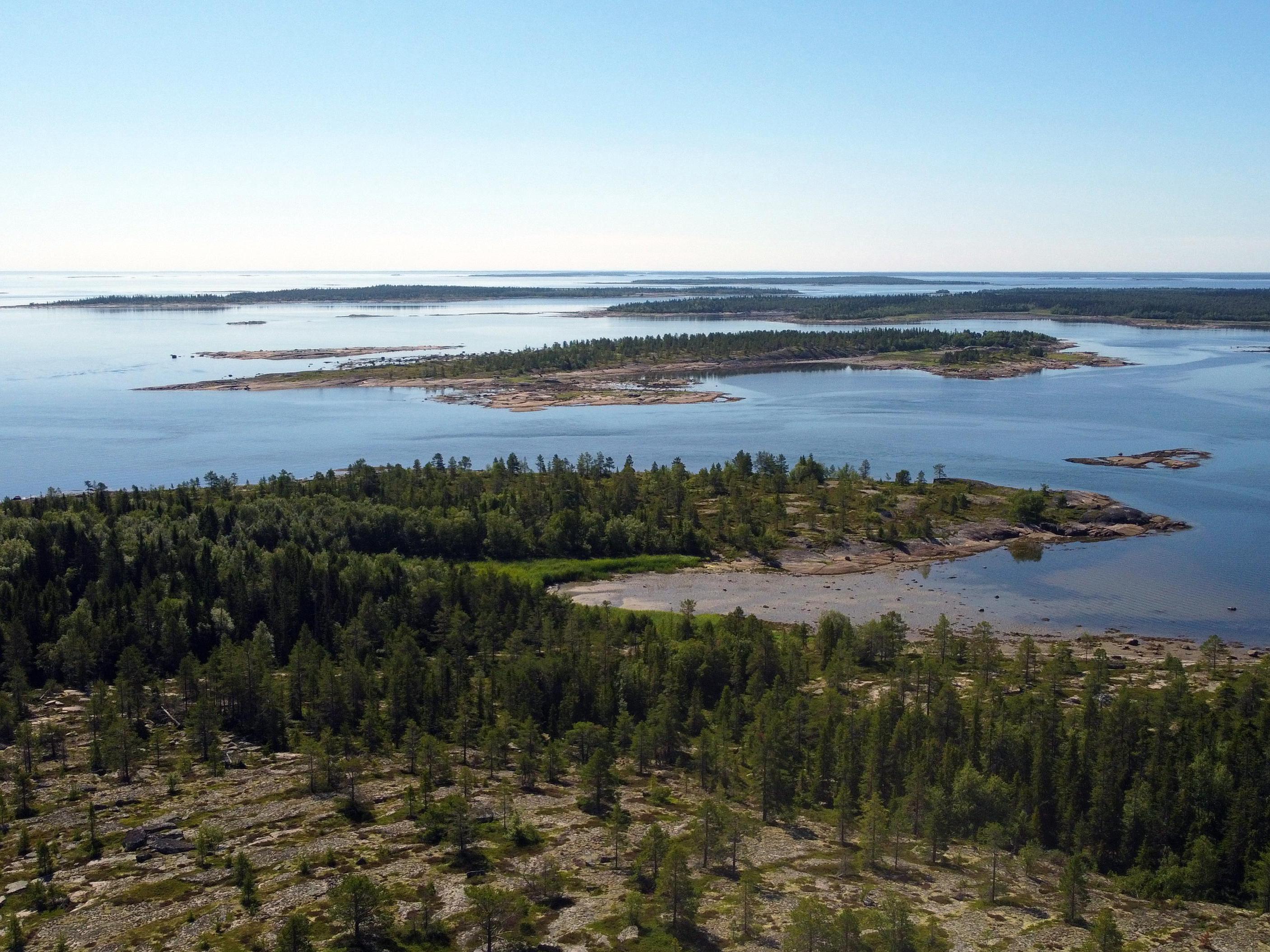
Marsakov«s journey began with a visit to the so-called Kem Skerries. They are an archipelago of numerous islands in the Onega Bay of the White Sea, located between the town of Belomorsk and the settlement of Rabocheostrovsk.
— To fully appreciate all the beauty of this island kingdom, — says Yevgeny, — you need to find a higher island and climb to its top.
In the morning fog, according to Yevgeny Marsakov«s recollections, the White Sea looks like milk poured all the way to the horizon. Hence, apparently, its name comes from. And when the fog disperses, the sea and sky merge into a single blue world without borders…
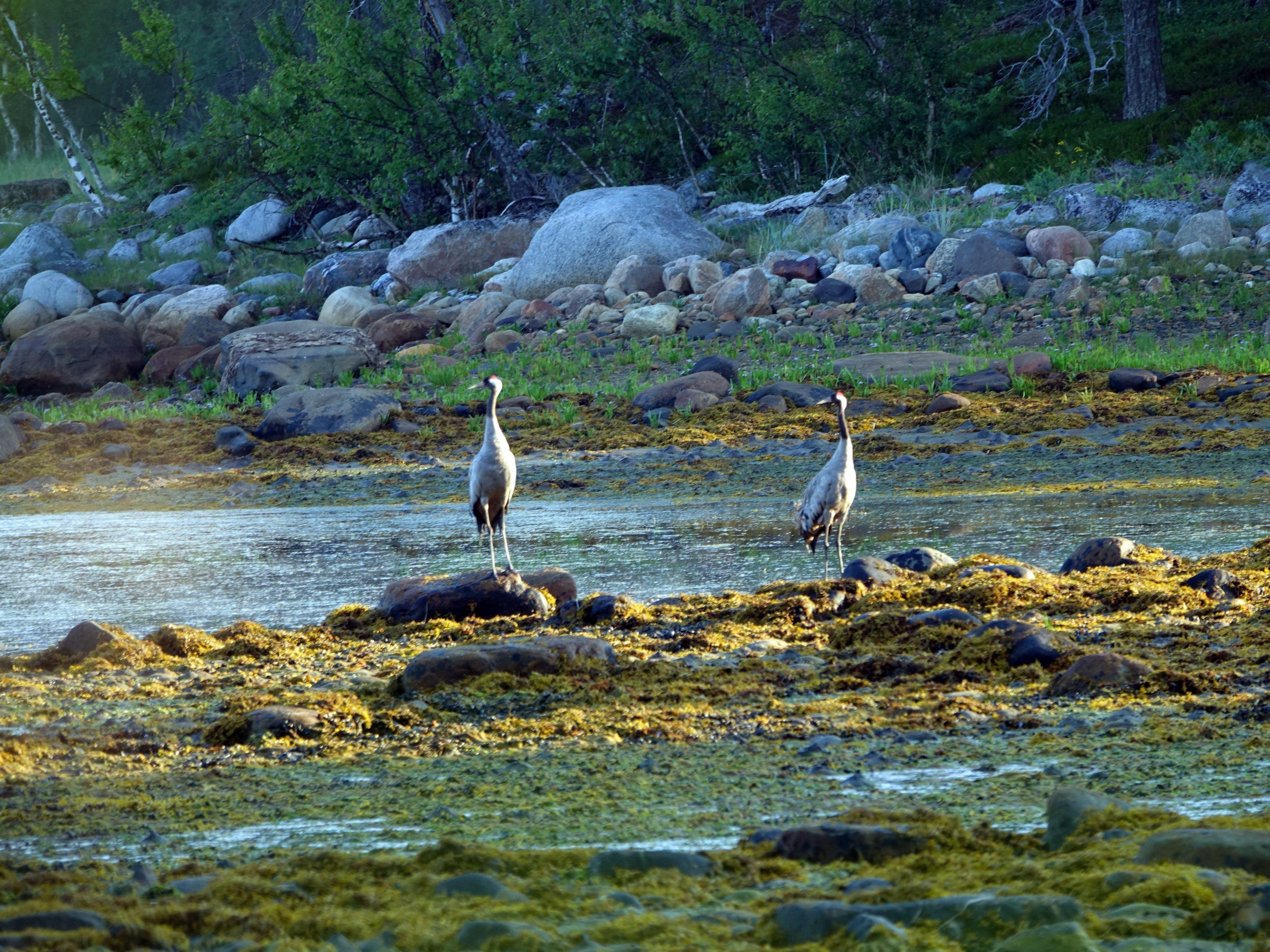
Cranes at Sosnovaya Bay.
How many islands there are in total in this archipelago is not known for certain. It is believed there are over a hundred. From tiny, rocky, vegetationless islets barely protruding above the sea surface, to large, forested islands, tens of meters high.
Navigating the skerries is not a simple task at all. The mainland shore and the islands, when viewed from a boat, merge into one continuous line. Under these conditions, only a navigator allows the traveler to understand where he is.
— But even a navigator is not enough, — explains Marsakov. — Tides and ebbs — that«s another factor that greatly complicates navigation on the White Sea. So it»s advisable to have a tide chart at hand. Tides and ebbs alternate approximately every six hours. The sea is constantly moving — it«s as if it»s breathing. Like it or not, you have to adapt to it.
When all that«s left is to pray
The Kem Skerries.
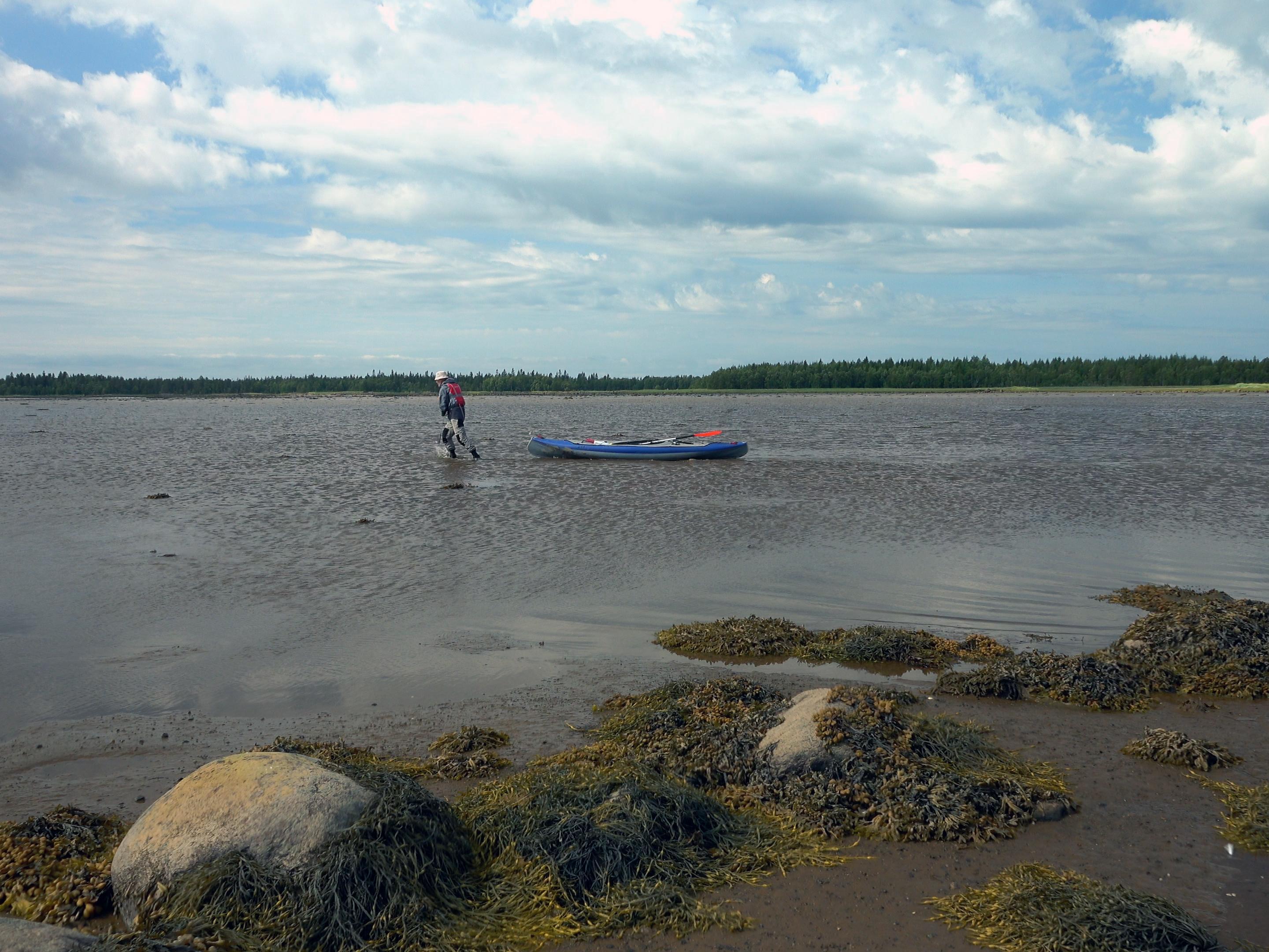
The sea in the area of the Kem skerries is quite shallow. Therefore, at low tide, the water recedes from the shore by tens or even hundreds of meters. Some straits between islands at this time turn into spaces filled with liquid mud. If you hesitate a little — you can get stuck, in the literal sense of the word. Then you have to sweat a lot, dragging your things and kayak over the sticky mud to solid ground, or temporarily become a barge hauler to drag the kayak to the water.
— But even if you drag it, — recalls Marsakov, — it may well turn out that the depth there is no more than ten centimeters (4 inches). You cannot paddle a kayak there, alas. So, you have to walk through the water as if on dry land again. And again, pull the kayak behind you.
The Kem Skerries reveal the incredible beauty of wild Russian nature.
When traveling by sea, according to Yevgeny«s stories, you must constantly think about replenishing fresh water supplies. A minimum of two liters (0.5 gallons) is consumed per day. And you must set out to sea with a water supply for at least three days. On the islands, fresh water can only be found in small depressions where it accumulates after rains.
— But that«s only as a last resort, — clarified Marsakov. — If you get stuck somewhere on an island due to bad weather. You can get fresh water only in a few streams flowing into the sea, and even then with great difficulty. The main difficulty is that at low tide it is practically impossible to approach these streams, and at high tide the sea water goes several kilometers inland, and the water in these streams will be salty.
The main danger when traveling on the White Sea is the winds, which can literally in fifteen to twenty minutes whip up a storm wave and turn a calm sea into a place where you need to take shelter. A squall wind suddenly breaks from under a cloud. God forbid you get caught by it in the open sea! Then all that«s left is to pray in the hope of salvation. No wonder the Pomor proverb says: »He who has never been to sea has never prayed to God«…
Bald Mountain on the White Sea
The Kuzova archipelago.
Next, Yevgeny Marsakov«s path lay to the eastern part of the Kem skerries, to an archipelago called the Kuzova.
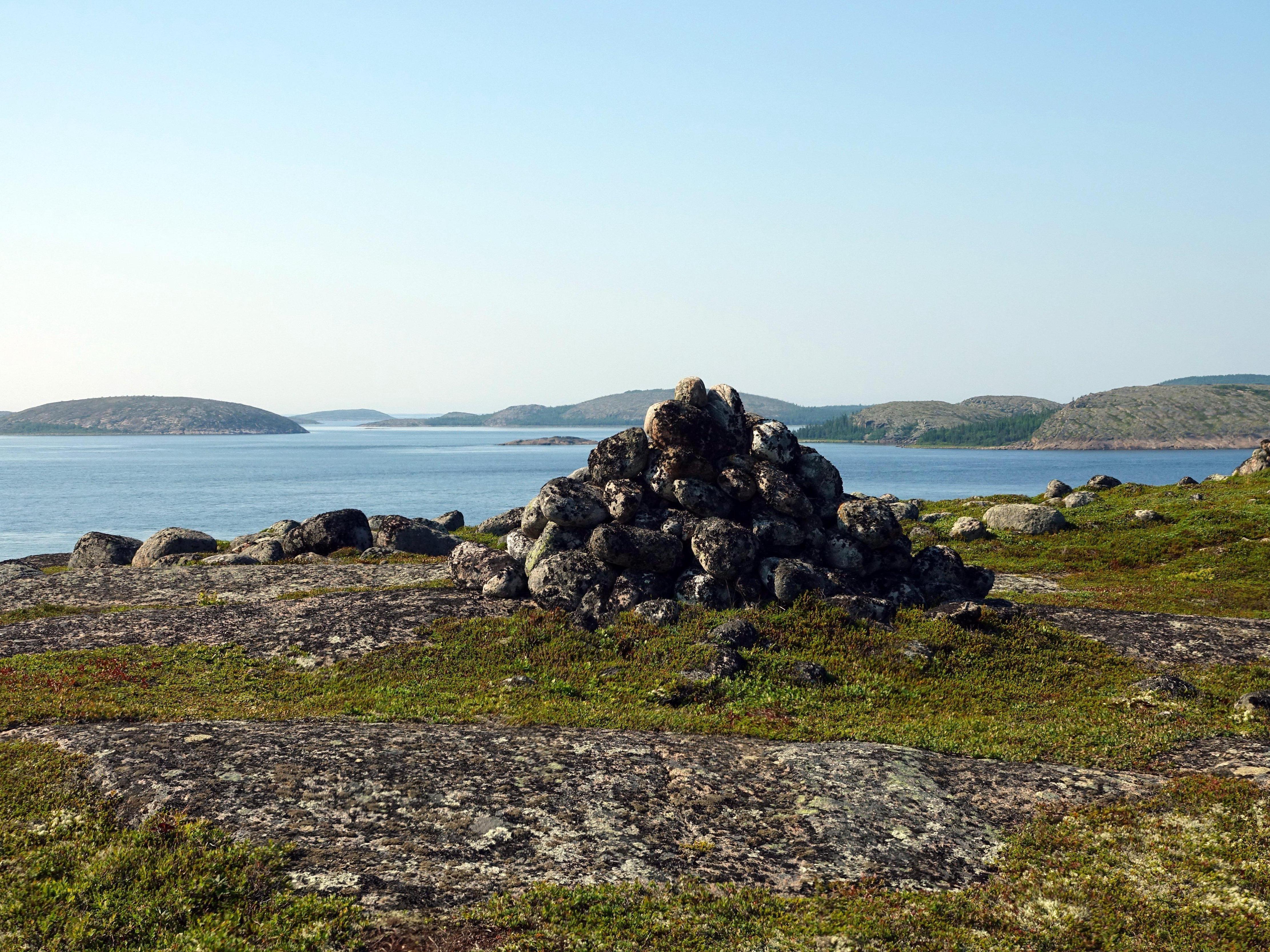
— This place is mysterious, shrouded in secrets, legends, — the traveler says. — The archipelago is located about fifteen kilometers (9 miles) from the mainland and consists of fifteen islands. The name of the archipelago, according to one version, comes from the language of the ancient Sami and means «spruce heads». Numerous ancient artifacts in the form of various man-made stone structures have been discovered on the islands. Many of them are a thousand years old or more. These are seids and labyrinths. Seids are most often a large boulder, one corner of which is raised above the ground and rests on one or two small stones. You can also see a boulder lying on several small stones. There are seids in the form of several flat stones stacked on top of each other. There are also stone pyramids almost as tall as a person. There are several hundred such structures on the islands of the Kuzova archipelago.
The largest island of the archipelago is called Russky Kuzov. Its length is three and a half kilometers (2.2 miles), and its width is about two kilometers (1.2 miles). It is also the highest in the entire Karelian White Sea region. The island«s height is 123 meters (403 feet).
On this island there is a mountain that bears the same name as the well-known elevation in Volgograd, a Hero City — Bald Mountain. On it, you can see the majority of the seids found on this island. In total, there are over three hundred such stone structures on Russky Kuzov.
Mysterious labyrinths
— Olyoshin Island, — says Marsakov, — is the most remote, the most mysterious of the islands of the Kuzova archipelago! It is famous, first of all, thanks to the stone labyrinths located on it. There are two here: a small one, about six meters (20 feet) in diameter, and a large one, about twice as big. (In our region, in Volgograd Oblast, something similar can be seen on the top of the mysterious Romanian Mountain, located in the Ilovlinsky District). Why such labyrinths were created in ancient times remains a mystery. According to scientists, they are of great historical value.
Pyramids on Olyoshin Island.
A natural object called Sugarloaf is also of interest here. This is an outcrop of quartz, whose snow-white crystals resemble sugar.
God«s Throne
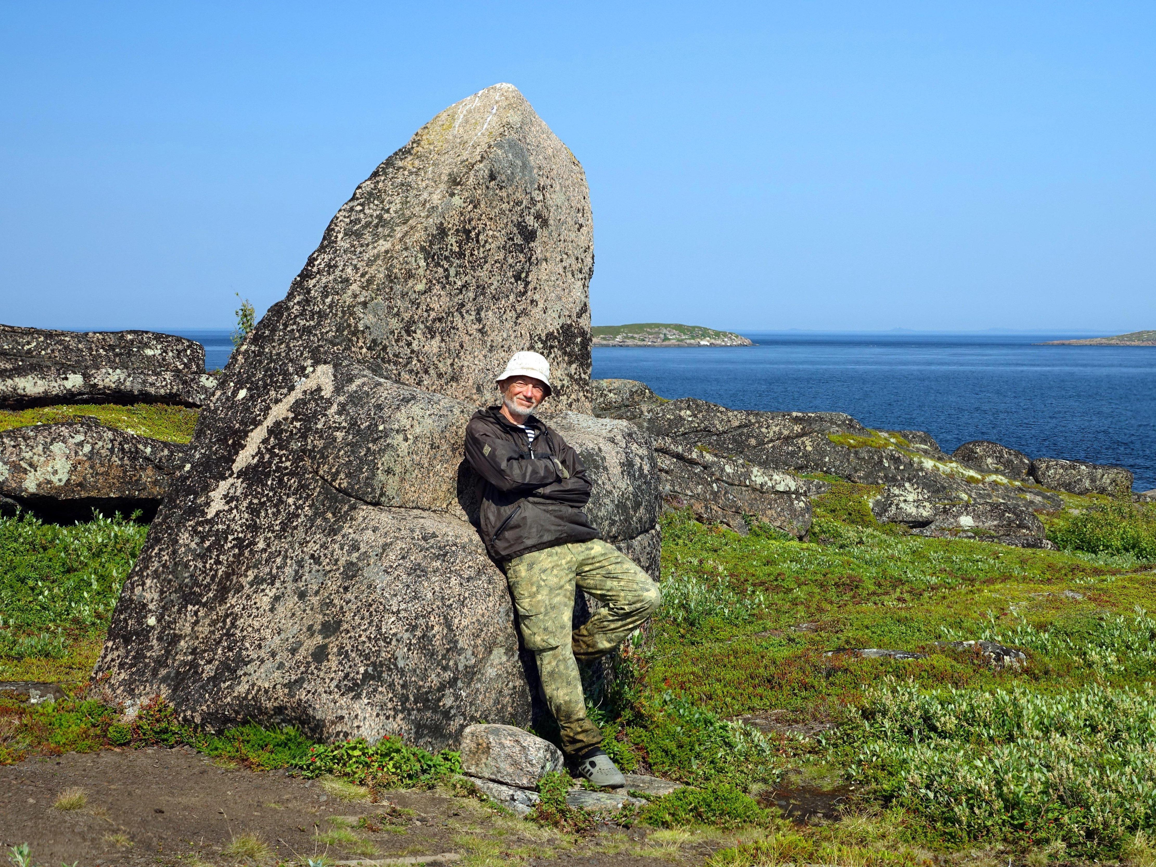
Yevgeny Marsakov by God«s Throne.
The Kuzova archipelago also includes a small island called Chernetsky. In the middle of it stands a large stone, shaped like a throne.
The history of the Karelian coast of the White Sea goes back to ancient times. It is here, according to some historians, that the ancestral homeland of humanity, known from myths and legends as ancient Hyperborea, could have been located. According to some legends, the strange, huge «throne» on Chernetsky Island could have been erected by local inhabitants in ancient times for their pagan gods. So this mysterious stone is also called God«s Throne.

Seids on Russky Kuzov Island.
Yevgeny Marsakov«s acquaintance with the Kuzova archipelago ended on the second largest island, called Nemetsky Kuzov. It began to be called Nemetsky (German) in those distant times when the Swedes tried to conquer these lands. First from the Novgorod Republic, then from the Russian Tsardom. The Swedes were then called »German people« in these parts. There is evidence that they visited this island, and here, possibly, was their fortification. Therefore, the island has since been called Nemetsky Kuzov.
— When you look at the seids of this island, — says the traveler, — you understand that they were silent witnesses to those ancient events. After all, several centuries are but a moment in the endless flow of time for them…
Solovetsky land
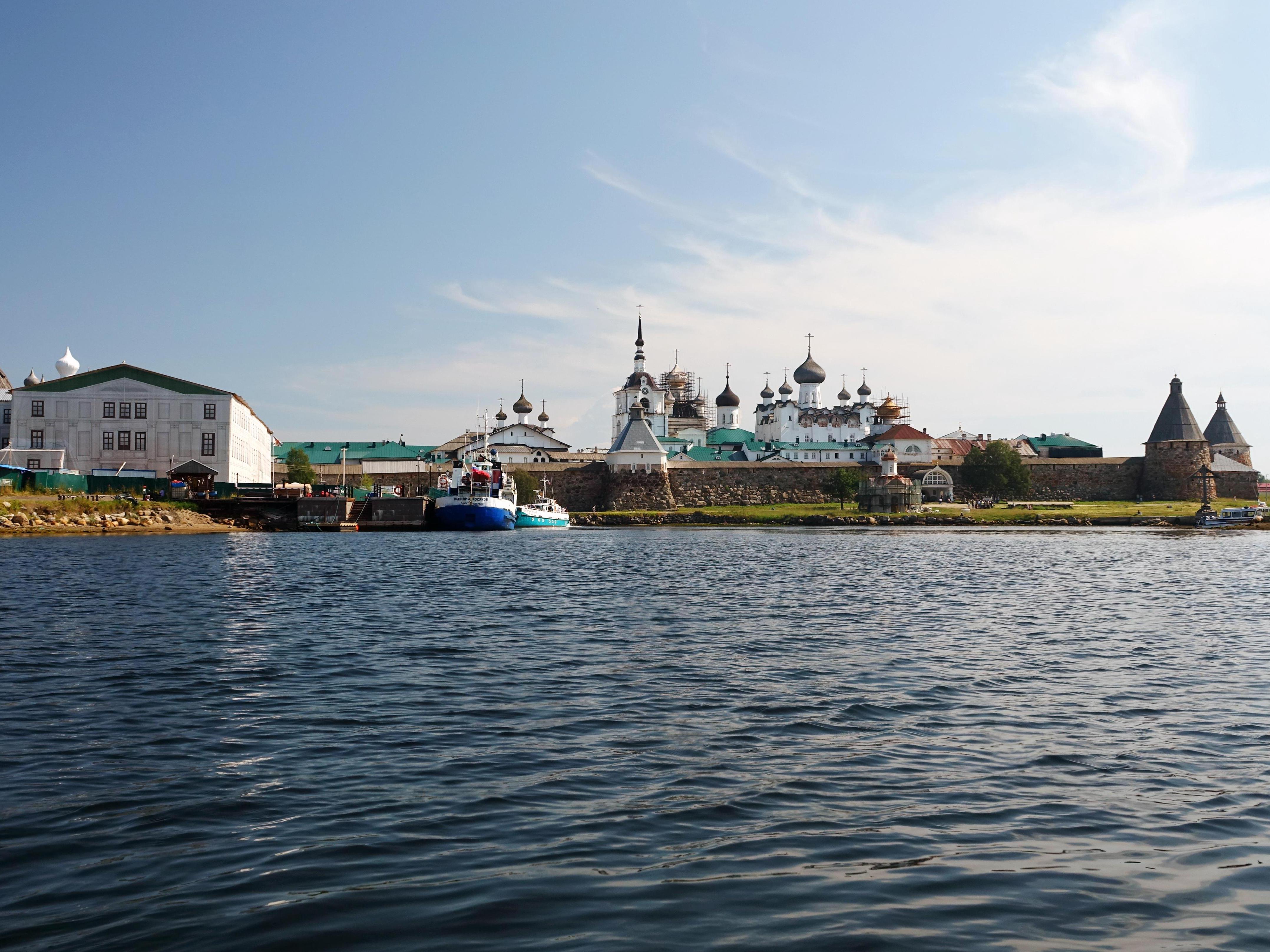
A view of the Solovetsky Kremlin from the sea.
The next archipelago visited by Marsakov while traveling in the White Sea region is Solovki. It is located about forty-two kilometers (26 miles) from the settlement of Rabocheostrovsk. It is separated from the nearest island, Olyoshin of the Kuzova archipelago, by a strait twenty-four kilometers (15 miles) wide.
— On the Kuzova, — Yevgeny told us, — I managed to get on a boat that was taking a group of tourists to Solovki. The travel time there is about an hour, in good weather.
Mount Sekirnaya.
Boats on Solovki dock in a bay called the Harbor of Prosperity.
All arrivals to the island are greeted by the ancient Solovetsky Kremlin. Its age is over four centuries. Its stone walls remember many dramatic events of the past. And from behind them, the domes of the churches of the even older Solovetsky Monastery, founded in 1436, are visible. From the opposite side, the waters of Holy Lake approach the walls of the Solovetsky Kremlin.
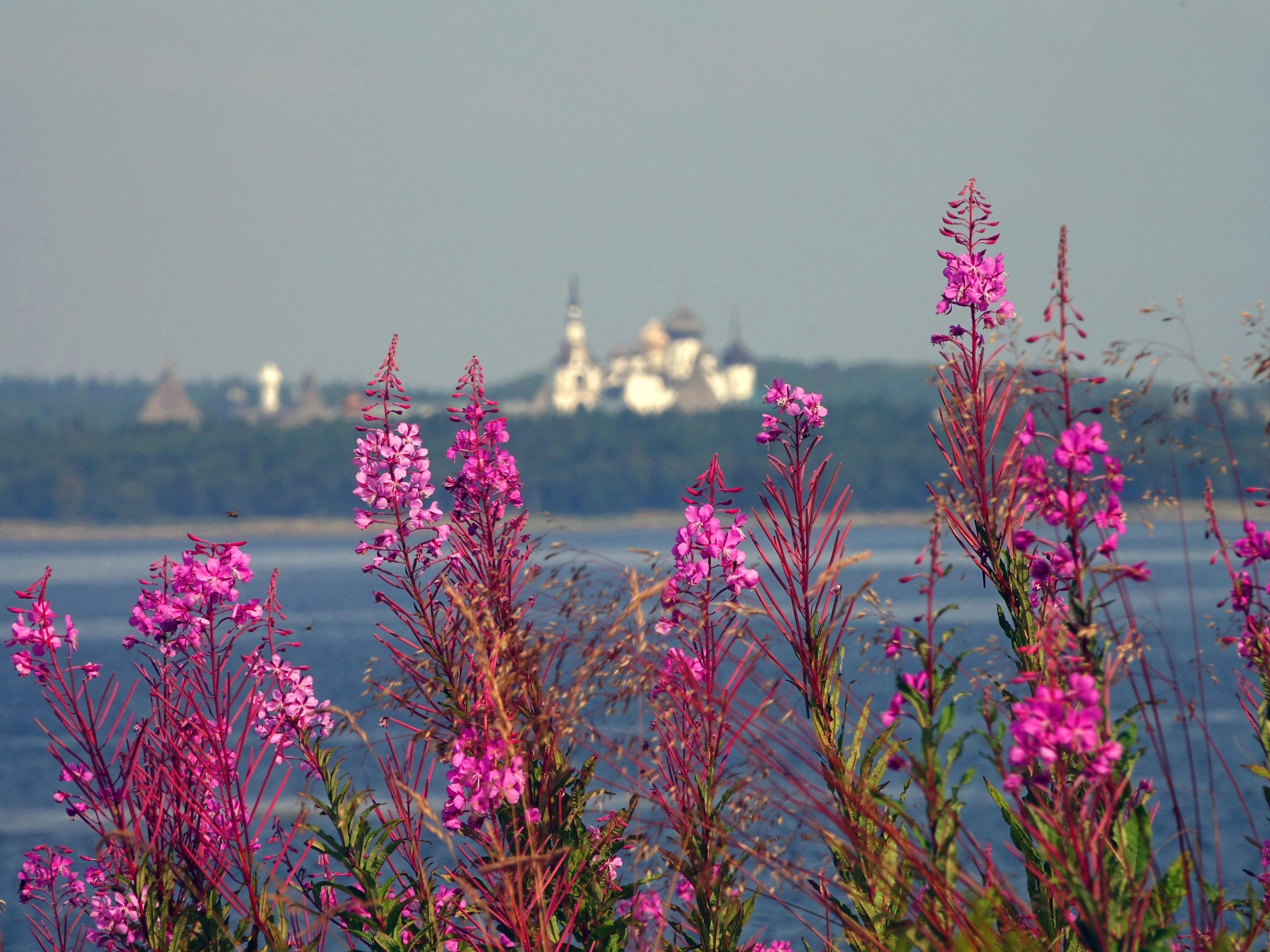
The Solovetsky Kremlin.
The Solovetsky archipelago consists of six large islands — Solovetsky, Anzersky, Bolshaya Muksalma, Malaya Muksalma, Bolshoy Zayatsky, and Maly Zayatsky. Besides them, about a hundred small islands are part of the archipelago.
How beluga whales roar and dance
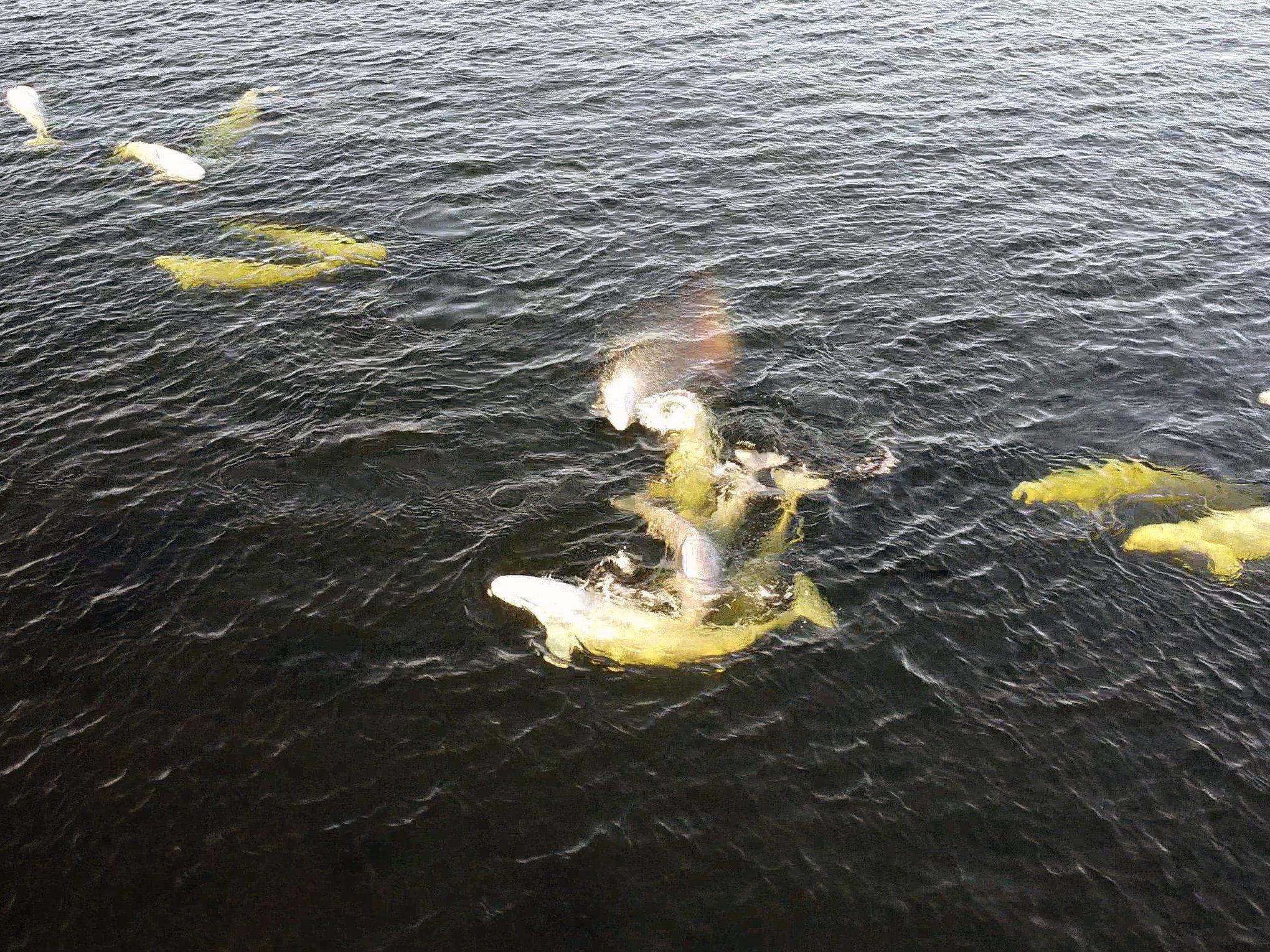
Beluga whales dancing near Beluzhy Cape.
Yevgeny began his journey around Solovetsky Island from the ancient walls of the Kremlin. The first stop was at a cape called Beluzhy. It is known for the fact that in summer, dozens of beluga whales — northern white whales, reaching six meters (20 feet) in length and weighing two tons — gather near it. In the old days, Pomors called this sea mammal «beluga». And therefore, this cape was nicknamed Beluzhy by them. Beluga whales circle there in a strange dance, very close to the shore, about ten meters (33 feet) from it. The sight, of course, is impressive!
— By the way, the expression «to roar like a beluga,» — explains Marsakov, — comes precisely from them, from the northern beluga whales. After all, the beluga (sturgeon) itself is, as you know, a fish, and it cannot roar! Whereas beluga whales not only roar but also make many other sounds.
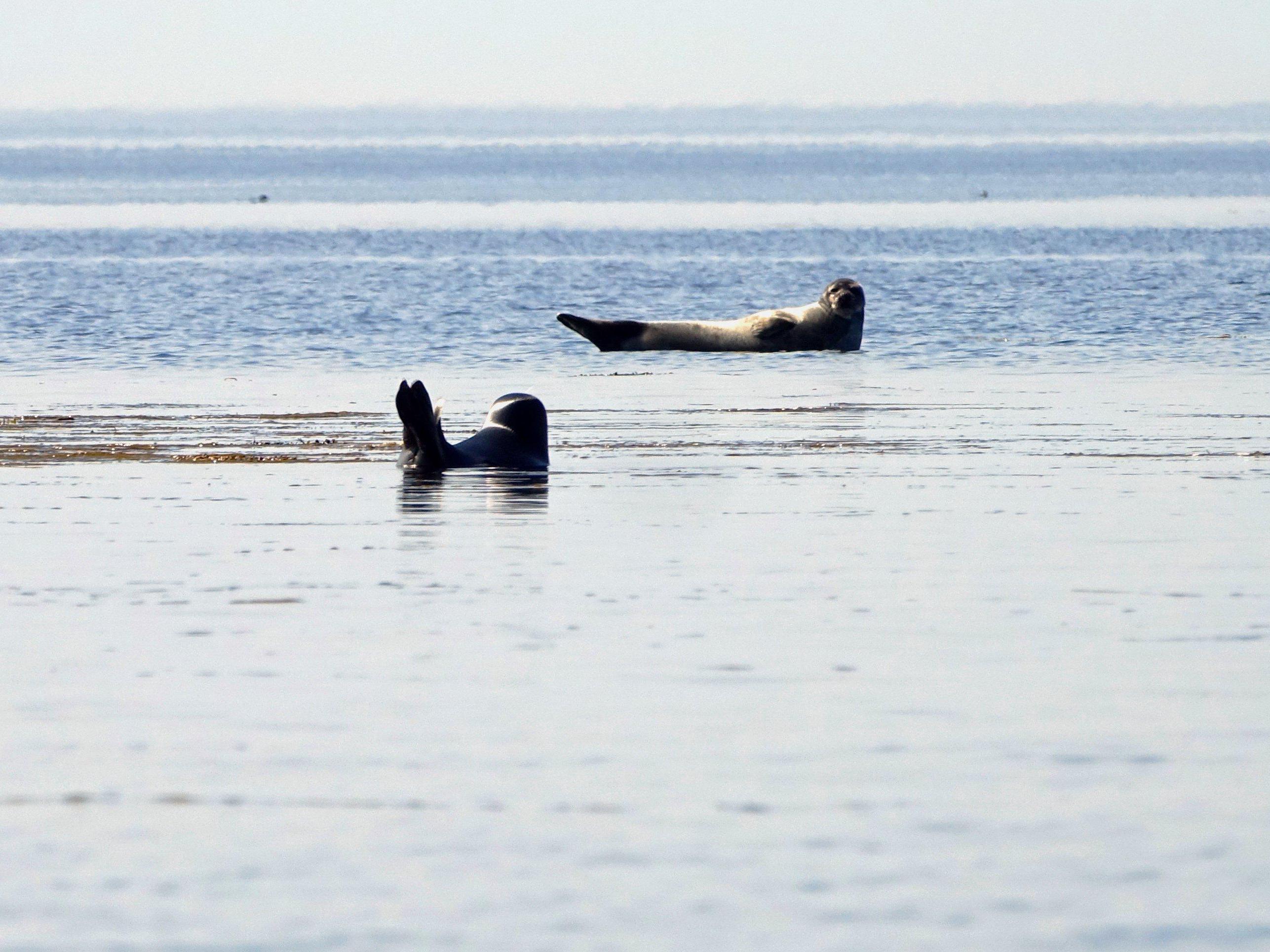
Seals resting while watching the infrequent tourists.
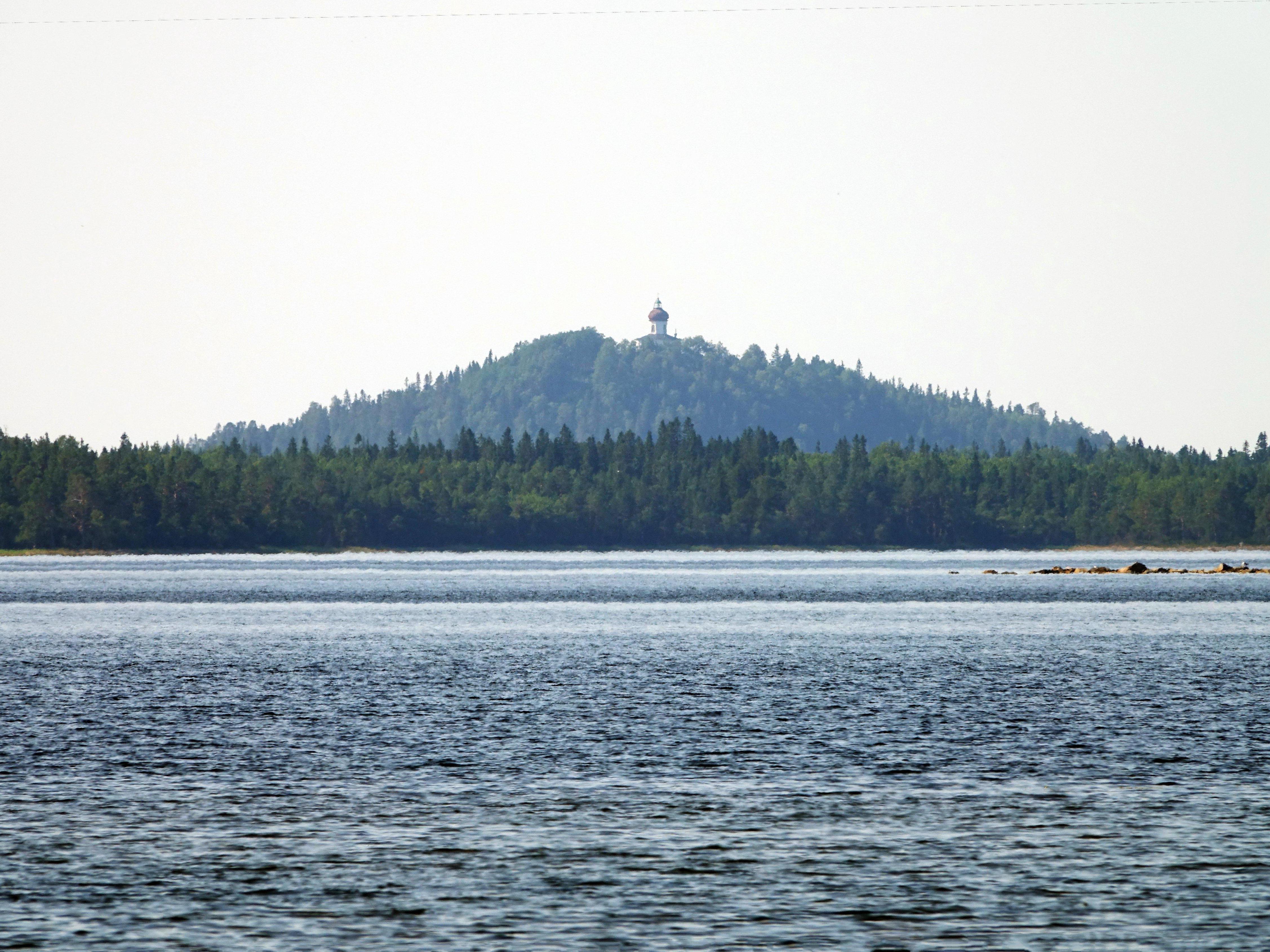
Further, Yevgeny«s path lay to the northern part of the island, where the large Sosnovaya Bay is located. From here, the highest point of Solovetsky Island — Mount Sekirnaya, about 80 meters (262 feet) high — is clearly visible.
In the southeastern part of Solovetsky Island, the shores are indented by deep bays. On one of the local capes, Berezovsky Cape, the most interesting ancient artifacts, whose age is measured in millennia, were discovered. These are various stone structures, clearly of man-made origin.
«Better not to say it, but to do it»
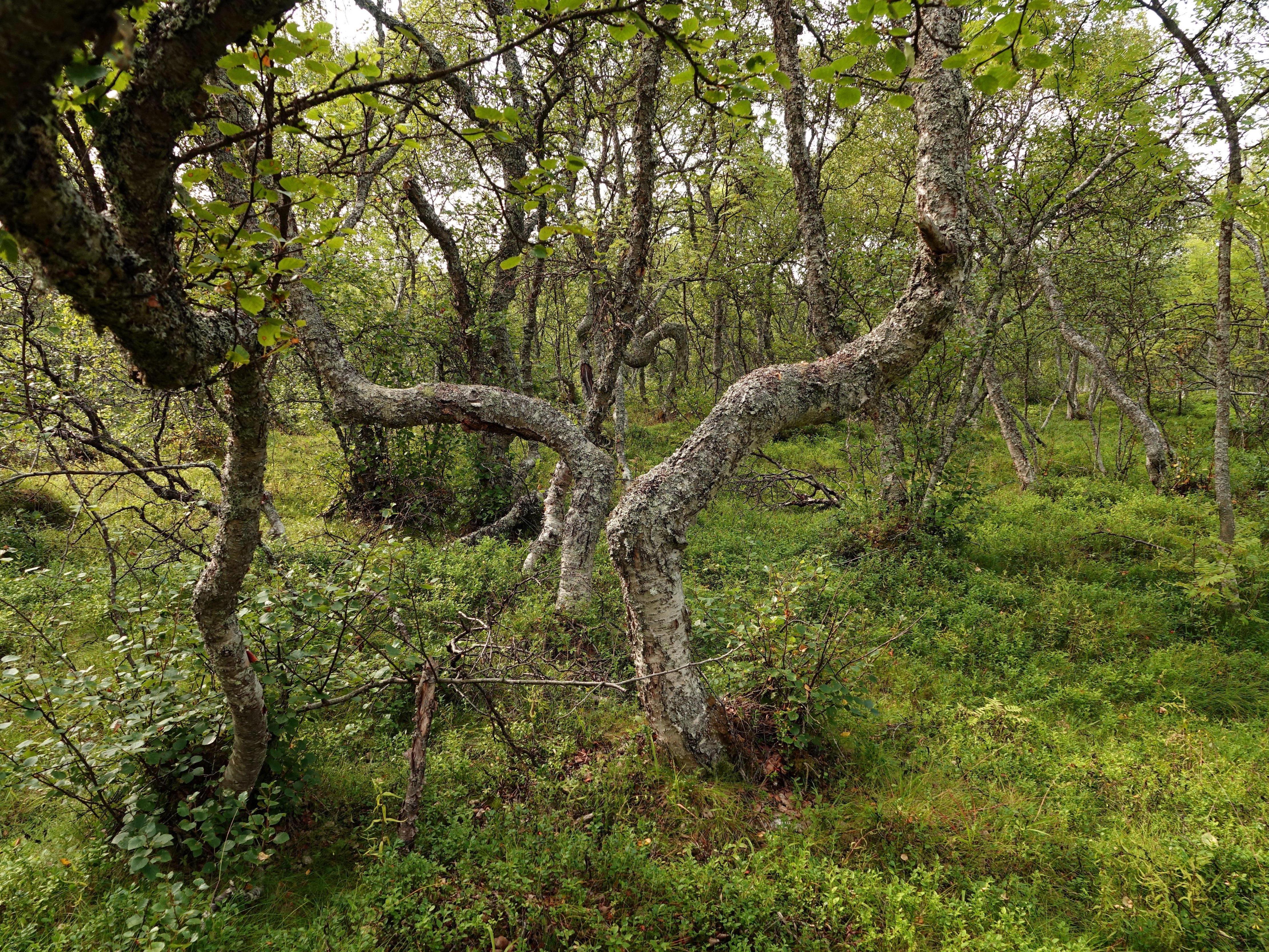
The «Drunken Forest» on Parusny Island.
Near Solovetsky Island, about one and a half kilometers (0.9 miles) away, lies Bolshoy Zayatsky Island. On it stands the Church of St. Andrew the First-Called, built by order of Peter the Great. And there are also over ten ancient stone labyrinths here.
About a kilometer (0.6 miles) from Bolshoy Zayatsky Island — there is a small island called Parusny. Although it is quite small, there is something to see there as well. For example, a cross laid out of boulders.
Also on this island, there is a grove that is very interesting to walk through. The tree trunks in that forest are bent and twisted in the most mysterious and fantastic way, giving them a mysterious appearance. (Almost exactly the same strange trees can be seen in Volgograd Oblast, in its north, on the famous Medveditskaya Ridge). It seems as if some fairy-tale monsters are reaching out their ugly tentacles towards you in this forest…
Meanwhile, Yevgeny Marsakov«s story about his summer journey through the White Sea region came to an end.
— It was a little sad, — the traveler says, — that I had to say goodbye to one of the most interesting corners of the White Sea region, and perhaps all of Russia. But, at the same time, you feel joy — from the fact that you managed to fulfill your dream, to visit these interesting places.
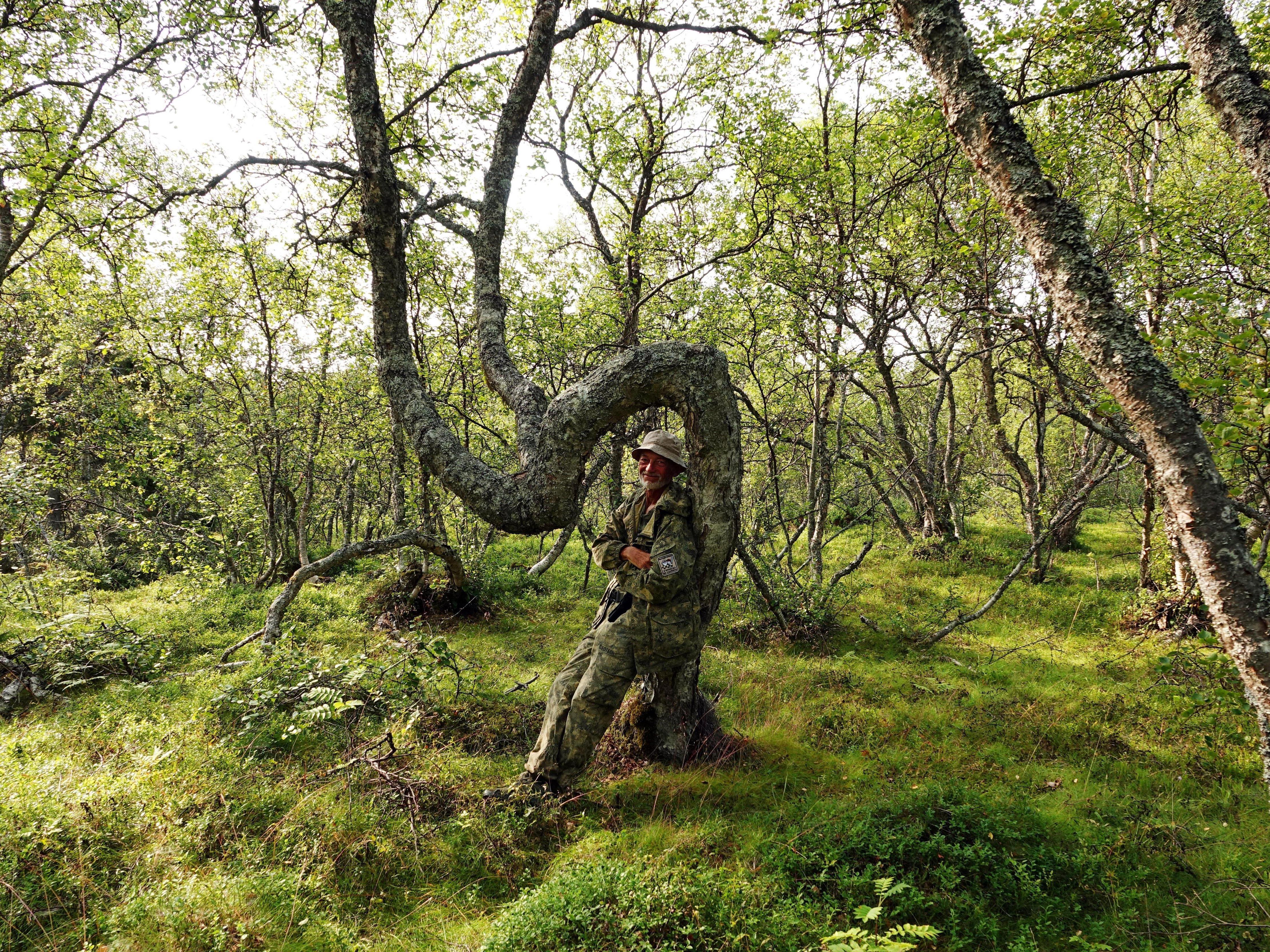
Under an arch.
Let us recall that traveling on the White Sea is far from always and for everyone within their strength, and the recklessness of tourists« actions sometimes ends in tragedy. So, last year, a group of tourists from Volgograd set out on a kayak trip on the White Sea from the Kuzova island chain to Solovetsky Island, but miscalculated their strength and failed to account for the worsening weather. Four people managed to be rescued, and three — died at sea. One of the surviving tourists from that fateful water trip told what happened that terrible night on the White Sea between Kem and the Solovetsky Islands.